The city of Hannover is now taking the next step on its way to becoming a smart city: a dynamic digital image of the city of Hannover will help to use and manage public spaces more intelligently in the future. Together with Deutsche Messe AG and other partners from science and industry, the state capital has launched the “5GAPS” project. Leibniz Universität Hannover (LUH) and the L3S research center are the central drivers of the cooperative project.
The abbreviation “5GAPS” stands for “5G Access to Public Spaces”. The long-term goal of the project is to recreate Hannover digitally and in real time in a multidimensional spatiotemporal coordinate system. This will create a dynamic digital twin, so to speak, of urban outdoor areas as well as indoor areas in buildings or commercially used halls.
The starting signal was given by Lord Mayor Belit Onay, Prof. Monika Sester from the Institute of Cartography and Geoinformatics at LUH, Managing Director Doris Petersen from the business development agency hannoverimpuls and Dr. Jochen Köckler, CEO of Deutsche Messe AG, during a press conference on February 14.
The virtual twin will map the environment in real time and anticipate changes through learning algorithms. The aim is to use the data platform in a variety of ways in the future: for example, for the highly accurate operation of autonomous vehicles or for the localization and tracking of goods. It can support navigation in buildings, optimize production processes, visualize planning, or even be helpful in reserving parking spaces for sales booths or moving vans. Citizens, companies, logisticians, traffic service providers, planning offices, the city administration, but also security forces such as the fire department are expected to benefit.
LUH is represented by several institutes, including the L3S research center, the Institute for Cartography and Geoinformatics, and Business Informatics. “We look forward to bringing our AI technologies to the 5GAPS project to positively impact the quality of life for Hanover’s residents and visitors, and to open a variety of business opportunities in our city,” said Daniel Kudenko of the L3S Research Institute.
The L3S is partly responsible for the technical side of the project, such as the design and implementation of a digital infrastructure, the development of the AI, and the construction of a database accessible to all partners in a cloud. In addition, L3S staff are working on state detection, such as whether a parking space is currently occupied, state prediction (the parking space is currently free but is expected to be occupied in the next two minutes), and automatic action planning with the help of the digital twin, such as drone navigation planning.
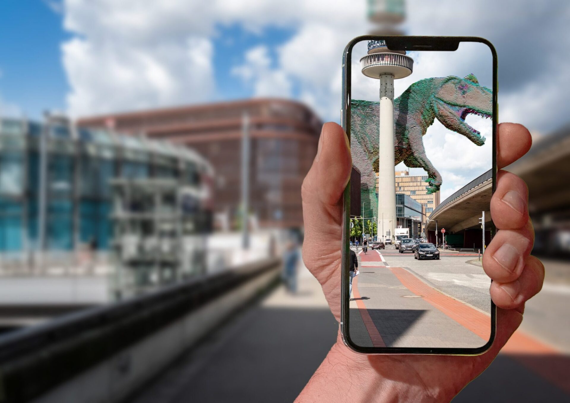
The potential applications of the digital twin are broad. Some use cases – when it comes to controlling a machine, for example – require only three-dimensional coordinates and data on the current state of the environment. Other applications extend the perception of reality by adding digital images in a location-based manner and superimposing them on reality. This so-called augmented reality requires a smartphone, tablet or corresponding glasses.
The digital twin of the city of Hannover is to be openly accessible and provide interfaces for developers from the start-up scene, established companies and research.
The first step will be to digitally map parts of the exhibition center in order to gather experience, develop the software for the digital twin and test applications. In later steps, the digital replication of first parts of Hanover will then take place.
The “5GAPS” initiative is being funded by the federal government with four million euros. The city of Hannover, hannoverimpuls, Deutsche Messe AG and companies from Hannover had previously successfully participated in a 5G innovation competition organized by the German Federal Ministry of Transport and Digital Infrastructure. The project will run until December 31, 2024.